The warband awakes on the 16th better rested than they had been in days. The warmth of the hearth had ensured restful sleep - the hot meal hadn't hurt either. With renewed vigor, the group left Huls and set off down the road.
Sometime during the night, the rain stopped, and the day dawned clear and bright with the crispness only a perfect autumn day can bring. Without a cloud in the sky, it promised to stay that way. The road, however, was still somewhat muddy, but even so, it had mostly hardened in the cold and now the sun added its heft to the task. Within the hour, the mud had been reduced to spots, and by the time the warband reached Beden an hour later, the road was amazingly dry. A quick scouting of Beden revealed it to be as deserted as Huls, and the warband did not tarry, Leriel being only a short distance away. Thw warband marveled at the clarity of the day - appreciating the full splendor of the Jahl Mountains behind them, and the Rayeshas ahead of them. They could easily see the three highest peaks at the top of the range.
"That one all the way to the left is called Fomenien," said Erdrick. "And will be our companion for much of the Fur Road."
By midday, the warband reached Leriel. It was bittersweet for those who had been here last as part of King Alegar's army. They could see the large temple of Ilvir, closed before the siege and untouched by both sides. The lower Jarin village had been deserted before, and remained so. As with the other villages, the fields lay untilled and unsown. The warband made its way through the village, the small lake to the north. As they approach the lower gates of the castle, a sentinel calls outfrom the gatehouse.
"Halt in the name of Hunris Hammarkel, Lord of Shien and Keeper of Leriel! Who are you, and what is your business here?"
[GM: I'm assuming everyone has access to the Leriel map - let me know if that's not the case. Obviously, I can't post it for copyright reasons. On a side note, I've always found this map a little odd, as the larger maps imply the town is on the river, whereas that's clearly not the case in the local map, plus there's this anomalous lake. I've assumed that the river is a few hundred yards to the east, and becoming a bit marshy on the other side of the field. The lake stretches a bit to the north and west, and is about four times as large as the portion on the map (and thus much too small to appear on the kingdom map).]
Halane 16, 730 - Leriel
59 posts
• Page 1 of 3 • 1, 2, 3
Halane 16, 730 - Leriel
![]() by Matt » Sun Feb 12, 2006 11:52 am
by Matt » Sun Feb 12, 2006 11:52 am
-
Matt - The GM
- Posts: 2556
- Joined: Thu Sep 16, 2004 3:38 pm
- Location: Weymouth, MA
![]() by Ulauf Seld » Tue Feb 14, 2006 5:42 am
by Ulauf Seld » Tue Feb 14, 2006 5:42 am
Ulauf stopping once challenged motions for the rest of the group to stop also and replies "We are clan Seld and we are on royal business. We request an audience with your Valhakar."
Turning to Igon, Ulauf continues in softer tones "Cousin, I think it wise not to let to many know our business. We carry a great treasure and it is best kept secret."
"You have the letter of introduction from the Princes, that should serve our purposes well enough for know."
Turning to Igon, Ulauf continues in softer tones "Cousin, I think it wise not to let to many know our business. We carry a great treasure and it is best kept secret."
"You have the letter of introduction from the Princes, that should serve our purposes well enough for know."
May Sarajin guide my arrow....
-

Ulauf Seld - Bailiff

- Posts: 427
- Joined: Sun Aug 07, 2005 7:45 am
- Location: Sydney, Australia
![]() by Igon Seld » Tue Feb 14, 2006 2:28 pm
by Igon Seld » Tue Feb 14, 2006 2:28 pm
Igon nods to Ulauf's sage advice and moves forward pulling the rolled letter from his jacket. In a clear voice... "I am Igon Seld and these are my felow clansmen, as my cousin has said, we have business with your Valhakar. Please take us to Lord Hammarkel warrior."
"We must drive the evil from our lands!"
Igon Seld
Igon Seld
-
Igon Seld - Knight

- Posts: 275
- Joined: Thu Aug 04, 2005 1:48 pm
- Location: Calgary Alberta Canada
![]() by Laenvan Hawkeye » Wed Feb 15, 2006 1:06 am
by Laenvan Hawkeye » Wed Feb 15, 2006 1:06 am
Wherever Laenvan has been, he takes his side by Lord Igon now to support him to the best of his capabilities.
-
Laenvan Hawkeye - Knight
- Posts: 252
- Joined: Thu Aug 04, 2005 4:29 pm
- Location: Bern, Switzerland
![]() by Matt » Wed Feb 15, 2006 10:42 am
by Matt » Wed Feb 15, 2006 10:42 am
"I know the name," says one warrior, and pointing to Jorst continues "and I have seen that one at Geldeheim. I shall take them up."
The spearman leads the warband into the earthworks and past the small guard tower where two more warriors peer down at them. Further up the gentle slope is another set of gates, this one unguarded. Stretching to either side is the surrounding wooden palisade. Leriel is an old-fashioned motte and bailey castle, but it still proved defensible against King Alegar's army. But those Jarin were gone now.
Through the gates the group could now see people - the first Jarin they'd seen in days. There were some Jarin and also Ivinian warriors standing guard. They nod to the warrior leading the group. The Jarin - sullen and dour - avoid eye contact.
Ahead, the castle motte looms, with its central stone tower. The spearman leads the warband around along the stone walls of the bailey, and to the castle gate, where two more spearman stand guard. The warband passes through into the bailey. The castle has five stone buildings inside the bailey, two to the right and three to the left. There is a catwalk running along the inside of the fifteen foot high walls, and the warband can see the wooden plank to the drawbridge of the motte. Four guards patrol the walls, but there is no other activity in the yard.
The spearman faces Igon and asks, "Will you see the Valhakar alone or with some of your companions, Lord Seld?"
-
Matt - The GM
- Posts: 2556
- Joined: Thu Sep 16, 2004 3:38 pm
- Location: Weymouth, MA
![]() by Igon Seld » Wed Feb 15, 2006 5:47 pm
by Igon Seld » Wed Feb 15, 2006 5:47 pm
Igon nods towards Soran... "Soran will stay and see to the needs of our mules, the rest are our clansmen or friends who are in service to the clan. They all know the task at hand and have gone willingly... so we all shall go to see your Lord if they wish, I leave it to them to decide."
"We must drive the evil from our lands!"
Igon Seld
Igon Seld
-
Igon Seld - Knight
- Posts: 275
- Joined: Thu Aug 04, 2005 1:48 pm
- Location: Calgary Alberta Canada
![]() by Ulauf Seld » Wed Feb 15, 2006 10:54 pm
by Ulauf Seld » Wed Feb 15, 2006 10:54 pm
Ulauf stepping forward and placing his hand on Jorst's shoulder says "Our place is beside Igon, we will come!"
May Sarajin guide my arrow....
-
Ulauf Seld - Bailiff
- Posts: 427
- Joined: Sun Aug 07, 2005 7:45 am
- Location: Sydney, Australia
![]() by Ulauf Seld » Wed Feb 15, 2006 11:49 pm
by Ulauf Seld » Wed Feb 15, 2006 11:49 pm
Perhaps Erdrick and Sven can stay with Soran.
May Sarajin guide my arrow....
-
Ulauf Seld - Bailiff
- Posts: 427
- Joined: Sun Aug 07, 2005 7:45 am
- Location: Sydney, Australia
![]() by Matt » Fri Feb 17, 2006 11:45 am
by Matt » Fri Feb 17, 2006 11:45 am
With Erdrick, Sven, and Soran remaining out in the yard, the spearman leads the group into the first building on the right. It is long, extending almost halfway along the curtain wall, and as the warband enters, they can see part of the building to the right is the kitchen, while the greater part of it is a hall. The warband appears to have arrived at an auspicious moment as the table is laden with food and drink. The pleasant aroma of roasted meat wafts towards them.
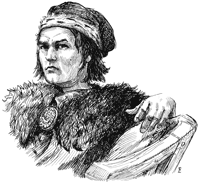
At the table are many men - huscarls by their look and numbering nine in all - feasting and talking. At the head of the table is a large, barrel-chested veteran with a full blonde beard that both Igon and Jorst recognize as Hunris Hammarkel. "Who be this?" he cries upon their entry. "They look familiar to me - Selds are you not? What brings you to Leriel?"
At the table are many men - huscarls by their look and numbering nine in all - feasting and talking. At the head of the table is a large, barrel-chested veteran with a full blonde beard that both Igon and Jorst recognize as Hunris Hammarkel. "Who be this?" he cries upon their entry. "They look familiar to me - Selds are you not? What brings you to Leriel?"
-
Matt - The GM
- Posts: 2556
- Joined: Thu Sep 16, 2004 3:38 pm
- Location: Weymouth, MA
![]() by Ulauf Seld » Sat Feb 18, 2006 9:43 pm
by Ulauf Seld » Sat Feb 18, 2006 9:43 pm
Ulauf lowering his head in defference says "Aye, Lord Hammarkal, Selds we are. I am Ulauf Seld son of Torsten Seld." Pointing to his brother he says "This is my brother Jorst huscarl to the King."
Directing his arm to his other companions Ulauf continues "This is Laenvan Hawkeye, warrior of clan Seld, this is Vagnar Granier a physician and this is Dragoran Shengaad of Sherwyn."
Ulauf continues "Our other companions Erdrick, Sven and our mule hander Soran have remained outside My Lord."
Ulauf pauses "Lord Hammarkal, this is Igon son of Eldred Seld our clan Valhakar and our commander."
Ulauf steps back several steps.....
May Sarajin guide my arrow....
-
Ulauf Seld - Bailiff
- Posts: 427
- Joined: Sun Aug 07, 2005 7:45 am
- Location: Sydney, Australia
![]() by Igon Seld » Sat Feb 18, 2006 11:02 pm
by Igon Seld » Sat Feb 18, 2006 11:02 pm
Igon gives a short respectful bow to Lord Hammarkal and steps forward...
"My Lord, I am Igon Seld, please forgive this interruption but my clansmen and I are on a errand for the Princes who rule in their father's place until he is returned to us."
"We are journeying south on a task set by them and we would ask of any news or information you may have concerning the activities of the Kaldorians or Thardans since you have ruled here? Also we need news of any rebel activity that may hinder us in our journey south. We also ask for your permission to rest here the night and replenish our supplies before continuing on at dawn My Lord."
"We must drive the evil from our lands!"
Igon Seld
Igon Seld
-
Igon Seld - Knight
- Posts: 275
- Joined: Thu Aug 04, 2005 1:48 pm
- Location: Calgary Alberta Canada
![]() by Laenvan Hawkeye » Sun Feb 19, 2006 3:42 am
by Laenvan Hawkeye » Sun Feb 19, 2006 3:42 am
The moment Ulauf presents him, Laenvan bows his head, as he has learned is the way of the Ivinans. No courtly bowing as he was used to.
-
Laenvan Hawkeye - Knight
- Posts: 252
- Joined: Thu Aug 04, 2005 4:29 pm
- Location: Bern, Switzerland
![]() by Vagnar Granier » Sun Feb 19, 2006 12:26 pm
by Vagnar Granier » Sun Feb 19, 2006 12:26 pm
Vagnar also nods his head in respect, casually observing the room for anything of interest.
They say I am mad...they make a good case.
-
Vagnar Granier - Squire

- Posts: 147
- Joined: Tue Aug 30, 2005 7:37 pm
- Location: New Jersey
![]() by Jorst Seld » Sun Feb 19, 2006 7:34 pm
by Jorst Seld » Sun Feb 19, 2006 7:34 pm
Jorst as usual is standing near his cousin and on his introduction bows his head and says "My Lord it is an honour."
-

Jorst Seld - Squire
- Posts: 151
- Joined: Thu Aug 04, 2005 11:30 pm
- Location: Wellington, NZ (Sydney, AU)
![]() by Jorst Seld » Mon Feb 20, 2006 7:53 pm
by Jorst Seld » Mon Feb 20, 2006 7:53 pm
Jorst waiting until Igon has taken his seat moves to the table and finds a place near one of Lord Hammarkels retainers and sits down turning towards his host he says "I thankyou for hospitality, Lord Hammarkel. You set a fine table"
After waiting until Igon and Lord Hammarkel have started eating Jorst begins to help himself to food....
After waiting until Igon and Lord Hammarkel have started eating Jorst begins to help himself to food....
Last edited by Jorst Seld on Mon Feb 20, 2006 8:01 pm, edited 1 time in total.
-
Jorst Seld - Squire
- Posts: 151
- Joined: Thu Aug 04, 2005 11:30 pm
- Location: Wellington, NZ (Sydney, AU)
![]() by Ulauf Seld » Mon Feb 20, 2006 7:54 pm
by Ulauf Seld » Mon Feb 20, 2006 7:54 pm
Ulauf after waiting until Igon has been seated then takes a seat near his cousin nodding his head to his host in appreciation. "I agree with my brother Lord Hammarkel, it is indeed a fine table."
He like his brother waits until his host and his cousin have started to eat before helping himself to the food...
He like his brother waits until his host and his cousin have started to eat before helping himself to the food...
May Sarajin guide my arrow....
-
Ulauf Seld - Bailiff
- Posts: 427
- Joined: Sun Aug 07, 2005 7:45 am
- Location: Sydney, Australia
![]() by Matt » Tue Feb 21, 2006 12:28 am
by Matt » Tue Feb 21, 2006 12:28 am
The spearman who escorted the warband says that he will see to the needs of those who have been left in the yard, and withdraws.
Lord Hammarkel and his huscarls return to their revelry, into which the group is drawn. The warband is delighted to see the lovely serving women, and equally delighted by the hearty fare. After a time, the food has been eaten, and while the mead still flows freely, the moment has come for talk.
[GM: I shall post Lord Hammarkel's initial response shortly, but feel free to talk amongst yourselves beforehand.]
-
Matt - The GM
- Posts: 2556
- Joined: Thu Sep 16, 2004 3:38 pm
- Location: Weymouth, MA
![]() by Laenvan Hawkeye » Tue Feb 21, 2006 6:49 am
by Laenvan Hawkeye » Tue Feb 21, 2006 6:49 am
Enjoying the feast and the mead Laenvan tries not to drink too much. As being a rather free-willed man he still stops his first impuls to talk to one of Lord Hammarkels Huscarl next to him... after all he is only a mercenary in the sold of Clan Seld. But then... it seems that Laenvan has made himself sort of a reputation under the Ivinians, after the battle at Fijaga. As far as he has learned living with them for a while now they judge a man more by his actions than by his lineage... and some Ivinian blood runs in him. Even if he still doesn't know from which clan. Hopefully nothing to blame...
Taking a hearth Laenvan takes his drinkhorn and raises it in praise to the Lord of this Hall (not too loud but so that the huscarl next to him hears him) in his best, accented Ivinan: "May Halea always smile upon such a generours lord and upon his men, who are lucky to serve him!"
[OOC - It is Laenvan's intention to start a conversation with one of the huscarls...]
-
Laenvan Hawkeye - Knight
- Posts: 252
- Joined: Thu Aug 04, 2005 4:29 pm
- Location: Bern, Switzerland
![]() by Matt » Tue Feb 21, 2006 1:41 pm
by Matt » Tue Feb 21, 2006 1:41 pm
The huscarl - who knows nothing of Laenvan, not having been at Fjaga himself - seems a bit put off by the mention of Halea. "The sentiment be good, but by Sarajin don't you mean?" he growls.
-
Matt - The GM
- Posts: 2556
- Joined: Thu Sep 16, 2004 3:38 pm
- Location: Weymouth, MA
![]() by Ulauf Seld » Tue Feb 21, 2006 11:23 pm
by Ulauf Seld » Tue Feb 21, 2006 11:23 pm
Ulauf sitting near Igon helps himself to his share of the food and drink. By the end of the meal there is a large stack of gnawed on bones laying on the plate in front of him.
May Sarajin guide my arrow....
-
Ulauf Seld - Bailiff
- Posts: 427
- Joined: Sun Aug 07, 2005 7:45 am
- Location: Sydney, Australia
![]() by Jorst Seld » Wed Feb 22, 2006 2:05 am
by Jorst Seld » Wed Feb 22, 2006 2:05 am
Jorst too enjoys the meal and drink. During the meal he retells those within earshot of the battle at Fjaga and how the southrons did dishonour to themselves by using withcraft to sway the battle.....
If the audience appear interested he continues the story with the groups efforts at Tandir and back. Highlighting Arren's audacity to visit the group during their 'raid' and daring the group to shoot him.....
[GM Edit: This was not Arren II, but Cedric Arlen, Earl of Westmarch.]
Jorst ending the story with "This could only be the work of witchcraft and those that practice it should not be trusted."
During the meal after he has finished telling his story he then draws his neighbours into a conversation concerning the Jarin in the area and why the villagers are empty. He will also try to find out how many huscarls/warriors Hammarkel can field and the strength of the local Jarin in the area. Trying to do so without raising any suspiscion if possible!
Once the meal has been concluded he leans back on his stool and says "My Lord, it is indeed one of the finest tables you have provided for us. On our return to Geldenheim I will be sure to tell those in court of the fine table you set your visitors!"
-
Jorst Seld - Squire
- Posts: 151
- Joined: Thu Aug 04, 2005 11:30 pm
- Location: Wellington, NZ (Sydney, AU)
![]() by Laenvan Hawkeye » Wed Feb 22, 2006 8:37 am
by Laenvan Hawkeye » Wed Feb 22, 2006 8:37 am
Laenvan looks the huscarl next to him up... is he greater than him... could he take him down with one blow if necesseray... He keeps his open smile. "No, no my big friend... I meant by Halea. See, there are as many gods as there are people and while you Ivinans have a knack for Sarajin, a great fellow, don't get my words wrong, the joy of life all hail from Halea the bountiful. Sarajin gives you strength, strenght to raise up eight times if you fall seven... strength of heart in the face of a enemy outnumbering you ten to one... but what is all this... when there is no joy to be had in life?" He looks up at the huscarl with a big and innocent looking eyes. But inwards he is ready to jump at a moments notice should an attack come...
-
Laenvan Hawkeye - Knight
- Posts: 252
- Joined: Thu Aug 04, 2005 4:29 pm
- Location: Bern, Switzerland
![]() by Matt » Wed Feb 22, 2006 11:26 am
by Matt » Wed Feb 22, 2006 11:26 am
The huscarl looks and Laenvan and replies, "If all joy flows from Halea why do you hold still as if expecting to fight? Could it be that you understand the joy of Sarajin better than you think?"
Before Laenvan can reply, Hunris Hammarkel says, "Hold, Torn, he is a southron remember. It is as Jorst Seld has said - they are different. Take this notion of witchcraft, perhaps the Ljarl holds it dishonorable - I would leave that interpretation to a priest such as Igon Seld here - but only to us. The southrons have their own code of honor, but it is not the Ljarl. And yet, I'm not convinced of the sorcery. Laevan here shoots an arrow at their King - Laenvan who never misses I take it and who uses a longbow - a weapon some consider dishonorable. A gesture from a King on a battlefield - hand signals perhaps, perhaps not, and an arrow with bad feathering goes astray. This is your evidence of sorcery? Thin indeed. Especially when all know that Arren II is a sorcerer from a race of sorcerors. So you expect it. I wouldn't trust him at all, sorceror or no. I would to Sarajin that we had some sorcery on our side. If we are to complain that a sorceror King from the south is not fighting according to our rules, then Orbaal is already lost."
Before Laenvan can reply, Hunris Hammarkel says, "Hold, Torn, he is a southron remember. It is as Jorst Seld has said - they are different. Take this notion of witchcraft, perhaps the Ljarl holds it dishonorable - I would leave that interpretation to a priest such as Igon Seld here - but only to us. The southrons have their own code of honor, but it is not the Ljarl. And yet, I'm not convinced of the sorcery. Laevan here shoots an arrow at their King - Laenvan who never misses I take it and who uses a longbow - a weapon some consider dishonorable. A gesture from a King on a battlefield - hand signals perhaps, perhaps not, and an arrow with bad feathering goes astray. This is your evidence of sorcery? Thin indeed. Especially when all know that Arren II is a sorcerer from a race of sorcerors. So you expect it. I wouldn't trust him at all, sorceror or no. I would to Sarajin that we had some sorcery on our side. If we are to complain that a sorceror King from the south is not fighting according to our rules, then Orbaal is already lost."
-
Matt - The GM
- Posts: 2556
- Joined: Thu Sep 16, 2004 3:38 pm
- Location: Weymouth, MA
59 posts
• Page 1 of 3 • 1, 2, 3
Who is online
Users browsing this forum: No registered users and 0 guests